Satellite Image File Services

Application

Geology
Agriculture
Forest Inventory Monitoring
Urban change detection
Natural resource monitoring
Mining and Construction
Disaster Response (Flooding, Oil spills, Extreme weather events)
Oil and Gas
Defense

Satellite Image Processing items

Pansharpening of Landsat-8 image over Algonquin Park, Ontario, Canada. 30m resolution spectral image sharpened to 15m while preserving spectral content
Preserving color balancing across images while adjusting difficult to match areas such as water can be accomplished easily with the ortho mosaic
  • RAW-Image Pre-Processing 

  • Atmospheric & Topographic Correction (ATCOR)

  • Atmospheric Compensation

  • Orthorectification

  • Pansharp 

  • Data Fusion

  • Mosaicing

  • Un-compressed image convert into compressed JPEG/JPEG2000 or others format

benefit
benefit
benefit

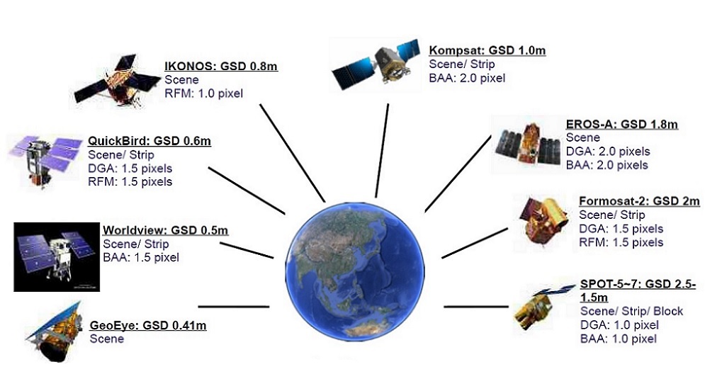
Supported Satellite Optical Sensors
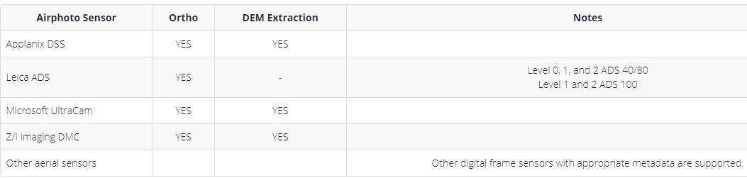
Aerial